How To Find The Location of This Image
by
This is an OSINT analysis of this image and its approximate location.
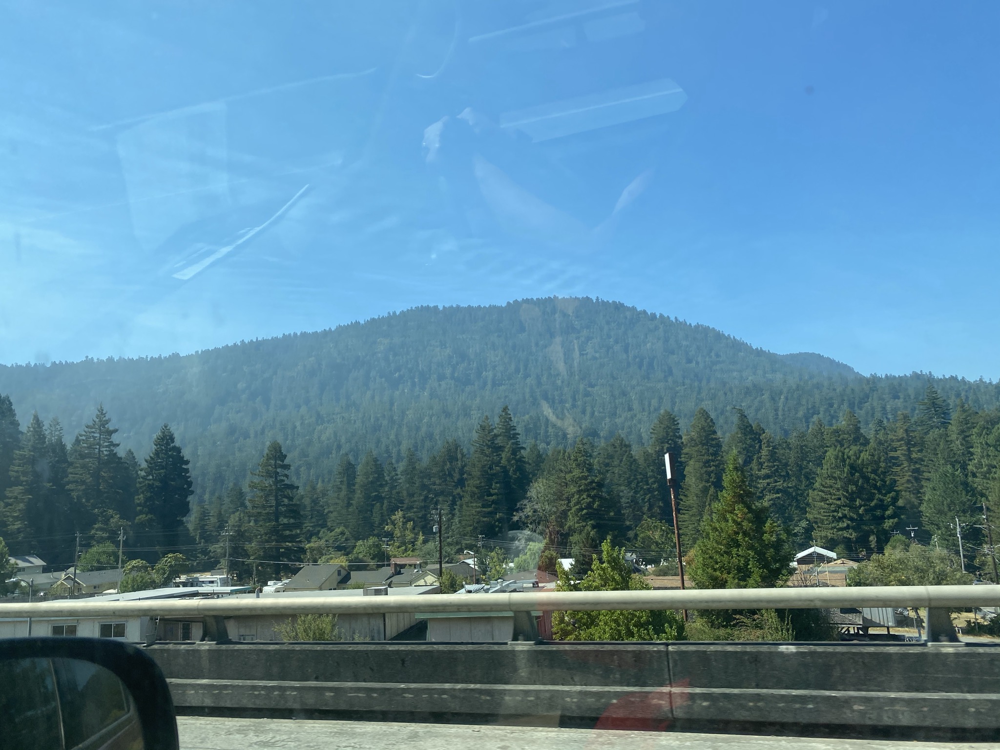
Here’s how I would do an OSINT analysis to find out the location of an image and the approximate time this was taken. We’re going to ignore the fact that I took this photo years ago and I know the approximate location.
Notable Key Facts
In the photo you can see several things: the terrain, the Douglas fir trees, power lines, a neighborhood and highway guardrails.
Where I would start first is to find the range of Douglas Fir trees. They’re spread across the Pacific Northwest.
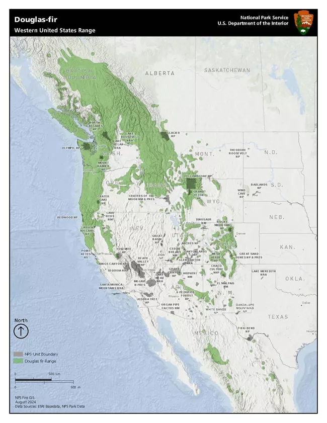
If we hypothesize that the cluster of trees towards the left hand side of the photo are coastal redwoods, that would eliminate WA and OR as potential locations because the coastal redwood range is limited to the central and northern California coast, with a small portion of that extending into Oregon.

Deducing further
Since the ranges for douglas fir trees and coastal redwoods in California are approximately the same, we need to look further to deduce whether this is northern California versus central California (Santa Cruz mountain range).
The guardrails seen in the photo would suggest that we are driving on a highway, not a road that passes through a town. The elevation also suggests that we are on a highway. There also appears to be another lane in the photo, suggesting that this is a 4 lane highway than just a country road. That eliminates Highway 9 which runs through Ben Lomond and surrounding areas. That leaves Highway 17, but if you look at 17 on a map, you can’t find find an area that has both power lines and is elevated.
That would leave us with coastal Northern California. This makes US 101 the strongest candidate because it is the principal multi-lane north-south highway traversing California’s redwood belt.
Highway 101
The stretch of Highway 101 that closely resembles the topography and terrain in the photo extends from Rio Dell to Leggett. That’s a 64.4 mile stretch. The terrain south of Leggett doesn’t match the one in the photo, since we are looking for a populated area that has a mountain ridge in the immediate distance. This also eliminates anything north of Rio Dell because the populated Humboldt area doesn’t match the key factors of a neighborhood with an elevated terrain immediately in the background. We can also rule out Trinity county since it is too sparsely populated to resemble anything in the picture.
The highway guard rails
There are a few points along Highway 101 where it is both elevated and is passing by a populated area. One area is by the memorial bridge in Rio Dell, but the guard rails don’t match the one in the photo. There are also no visible power lines.
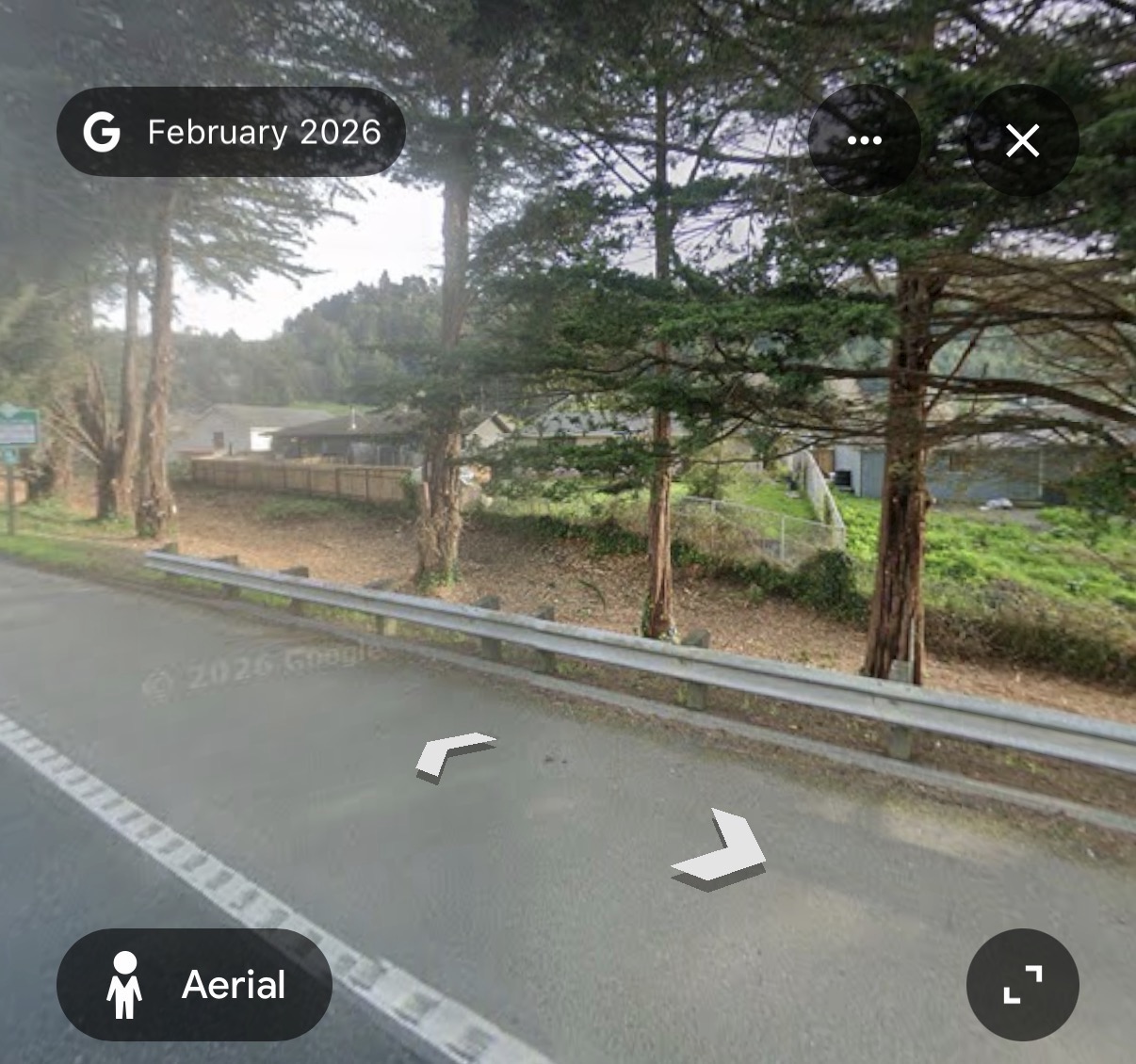
The second area I found where the highway is elevated is on an overpass through Weott. This is the only other candidate I identified than Rio Dell where highway 101 has highway guardrails next to a populated area. On Google Maps, you can also see that the guard rails match the ones taken in the photo.
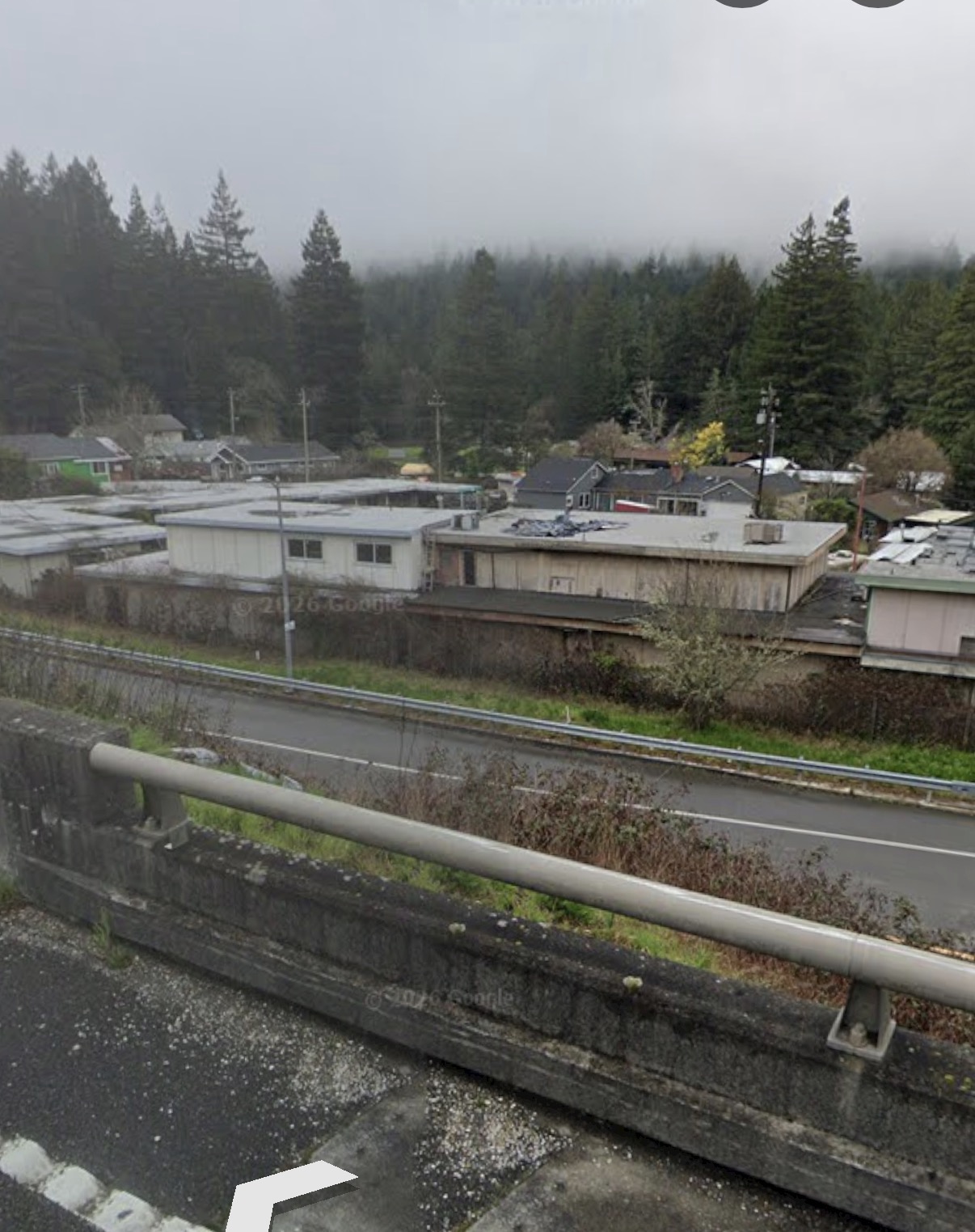
The coordinates for the location in this picture is (40.3214001, -123.9212946).
tags: osint - geoguessr